Generalkoe Zapadnoe
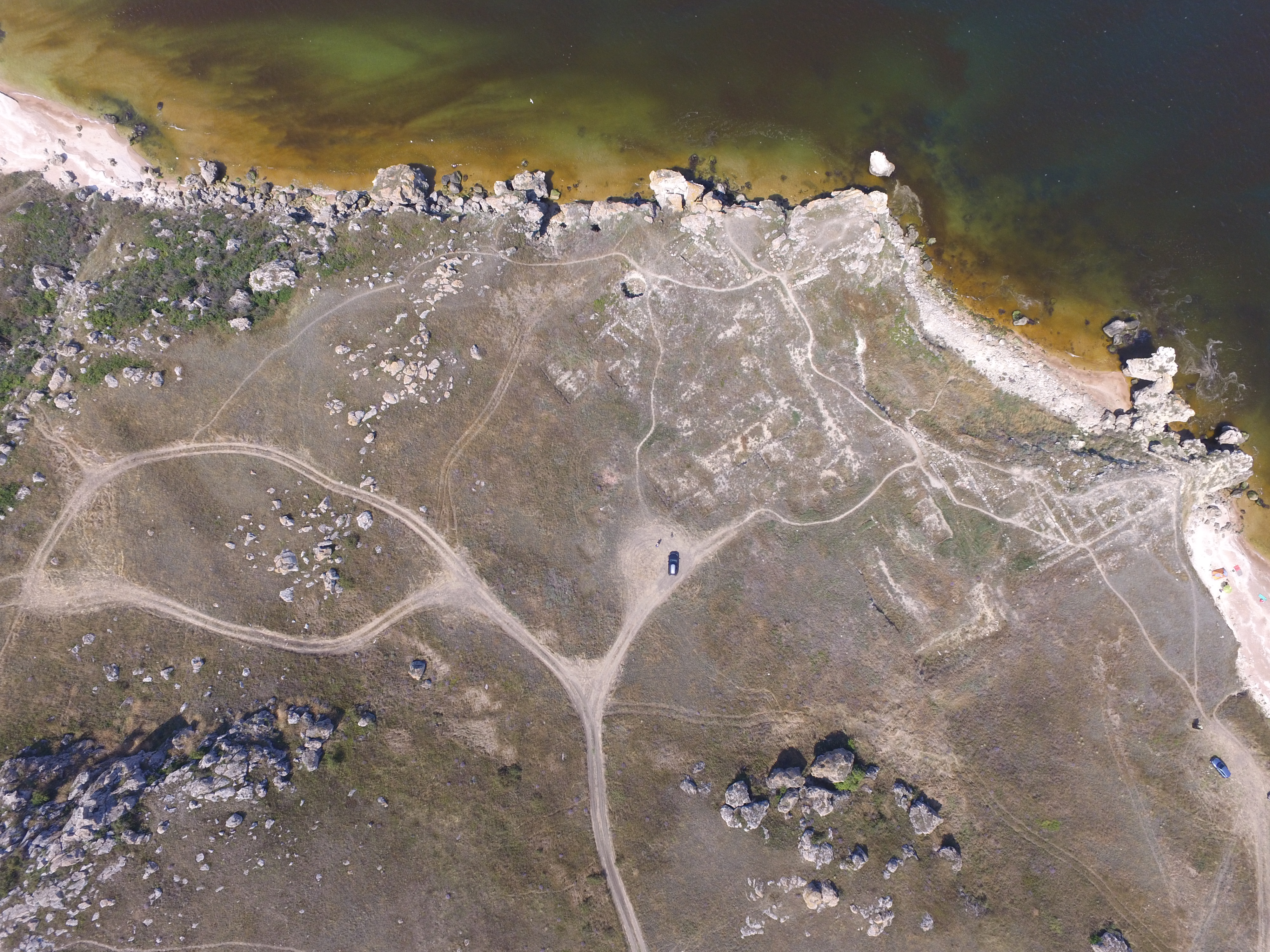
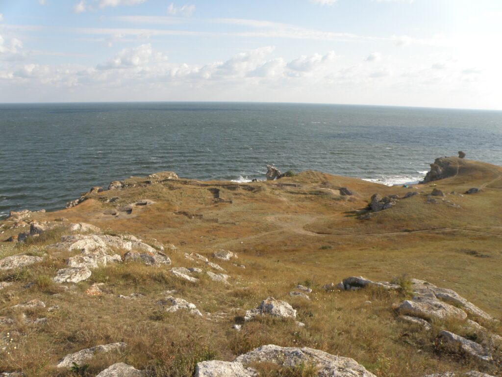
The “Generalskoe-West”settlement is 25 kilometres north-west of Kerch in a coastal valley to the West of the so-called “General’s Bay” (View of the Bay, Topography, Plan). The settlement has a total area of approximately 4,550 square metres and consists of three sections or Blocks which are close to each other and linked by the fact that they belong to one and the same system of fortifications (two lines of defences made up of ditches and ramparts). Archaeological excavations were carried out in the settlement in 1980, 1982-1988, 1991, 1992-1995, 2001-2002, 2007 and 2009.
North Block (Block Ι): it has an area of 1,500 square metres and comprises two rows of rooms linked to each other at right angles and sharing an east wall (30.5 metres long) and a south wall. These two walls also form the outer edges of the Block. The south wall consisted of two sections (24.5 and 31 metres in length) erected between three towers (measuring 9.8 x 8.8 metres, 8.2 x 8.8 metres and 10 x 10.5 metres). The outer walls and towers had been built during the first construction period and subsequently a winery was erected at the spot where the south-east tower had stood before being dismantled. That tower was subsequently rebuilt so as to provide living accommodation.
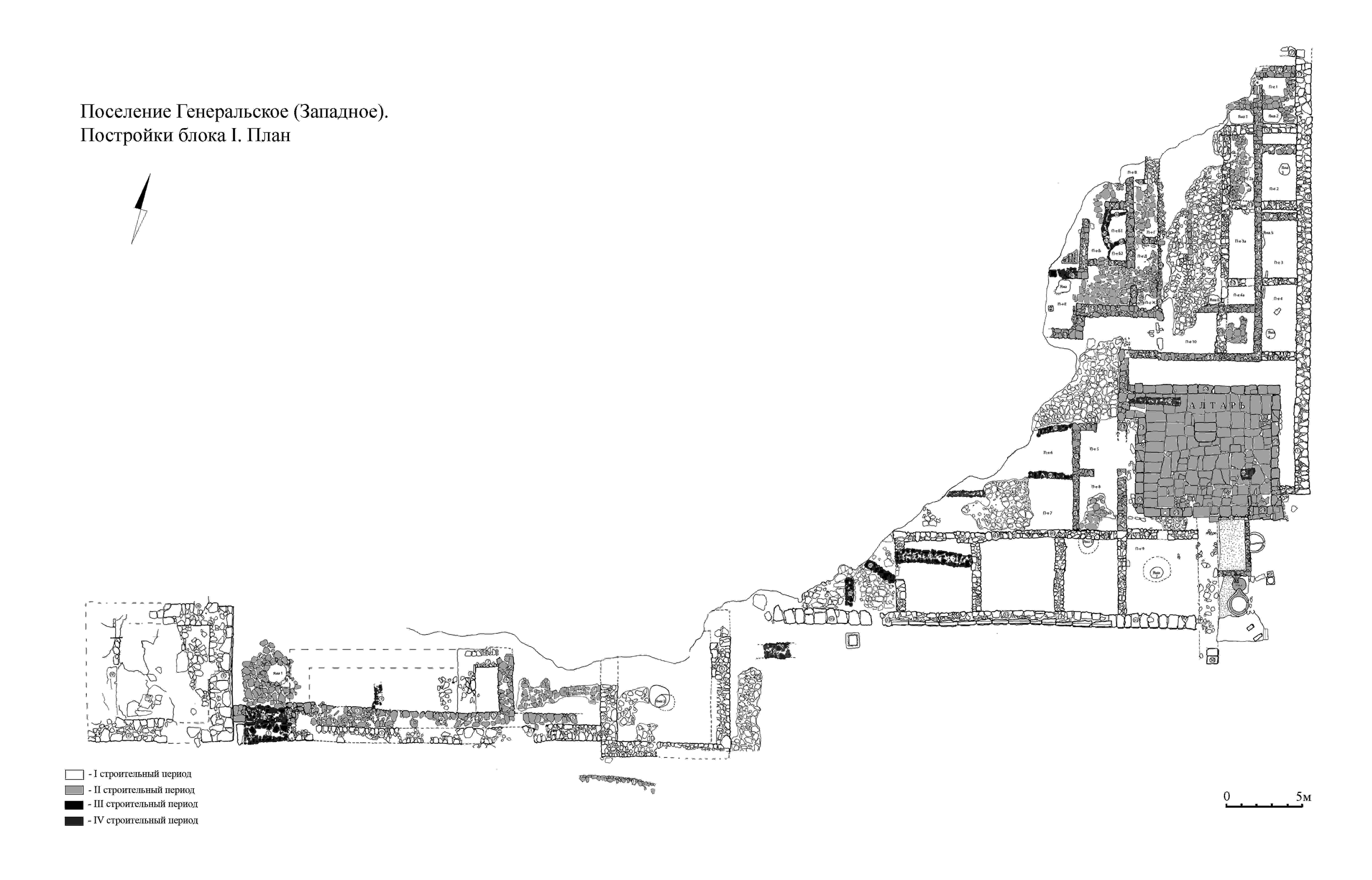
The western part of the North Block (extending from the west tower to the middle tower) had been severely damaged by coastal erosion. A rectangular, semi-basement room had also survived and at the eastern edge of the west tower there was part of a paved area, where a road led to a gap in the outer wall.
During the second construction period the room described above was filled in and new walls were built above it: one of these was erected along the whole inner edge of the outer south wall.
The north-eastern part of the North Block consisted of rooms, which were rectangular and similar in size (4, 4.4 and 5 metres by 4.5 or 4.6 metres) built within shared east and west walls. The east wall (32.5 metres long) extended eastwards as far as the corner tower (south-east tower), thus providing the defensive wall for the block.
To the South of the afore-mentioned rooms there was a large rectangular courtyard (120 x 140 square metres), adapted in the second construction period as a peristyle courtyard, and also a corner tower.
To the East of the corner tower and to the South-East of the courtyard there was another row of four rectangular rooms (measuring 5 x 4.6, 5 x 4, 4.9 x 5.1 and 4.8 x 4.6 metres) built up against the southern defensive wall of the Block. These rooms remained virtually unchanged during the whole existence of the settlement.
To the West and North-West of these rooms, small paved areas were cleared, which had probably been parts of a single paved courtyard.
In the second construction period the corner tower was dismantled and the ditch filled in; the north-east rooms were re-designed and the peristyle courtyard was built in the south-east corner, while in the western part of the Block new rooms were built on the terraces.
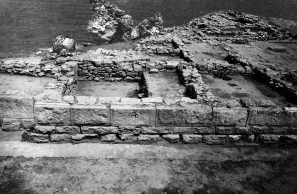
In the centre of the courtyard with the peristyle there stood an altar. Walls had been erected round the courtyard’s perimeter, which were 25cms high and made of trimmed stone slabs, thus providing a stylobate. The total size of the paved area was around 70 square metres. In the North and East of the courtyard, further rooms were added, which served as a rather unusual entrance hall.
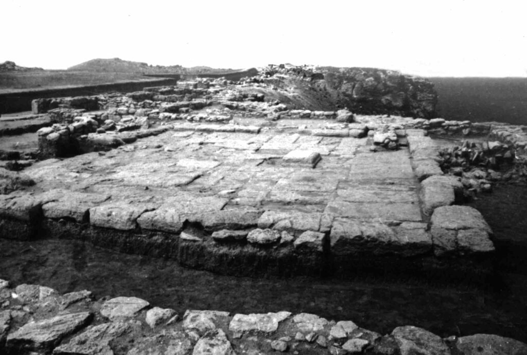
Further south, where the corner tower had stood previously, that had been replaced by a winery containing two pressing troughs, two round troughs and pits in which pithoi could be stored vertically.
In the north-western part of the Block there is a slope descending to a small bay. Originally rooms had been built on some of the slope’s terraces. A significant number of these structures had been destroyed by coastal erosion but the eastern and southern retaining walls had survived well, along with some small rooms and the remains of the winery.
The buildings and structures dating from the third construction period have been cleared mainly to the West of the courtyard with the peristyle. These remains include some broken walls and the layer relating to the destruction and ruin of the settlement, which had formerly covered virtually all the rooms and paved areas. This layer of destroyed material consistеd of loose loam containing ash (with a thickness of between 5 and 25cms). The layer also contained large numbers of pottery sherds and also stones and small pieces of coal and of unintentionally fired clay coatings. The traces of fire on the coating of the floors and on stones testify to the fact that a fire had been burning when the settlement was destroyed. Arrowheads of a Scythian type have been found beyond the outer walls of the site.
Above the layer of destruction, four seriously broken walls dating from the fourth construction period were cleared.
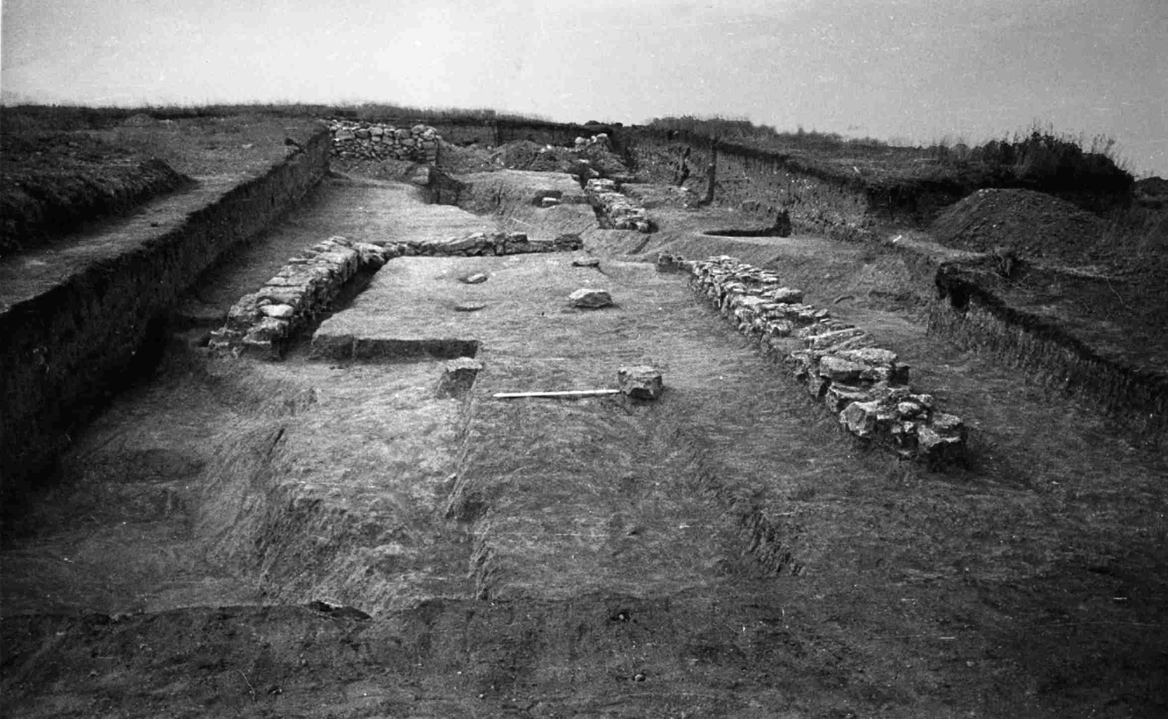
The East Block (Block ΙΙ) of structures was unearthed 20 metres south of the north-eastern part of the North Block. This block did not share any walls with other groups of buildings and was at a slight remove from them. In this particular part of the settlement the maximum thickness of the habitation level was two metres. The main building in this Block was a square room with a total area of 21.2 square metres. During the second construction period, two rectangular rooms were built abutting the south room and the courtyard between the two additional rooms was paved.
The south-east corners of these structures had been destroyed by the first (outer) ditch and the north-east corner of the square room by the building of the second (inner) line of defences (a ditch and rampart).
A wall was discovered 2.2 metres west of the square room, which stretched precisely from North to East and which interlinked at right angles with another wall extending in a West-East direction over a distance of 15 metres. The whole space between these walls was covered with a thick layer of yellow loam constituting the floor of a courtyard or the top coating of a courtyard floor. It is possible that these walls had enclosed a temenos. A peristyle courtyard had been built up against the east part of the north wall from the South and in it two rows of stones were discovered, which had been arranged parallel to the longitudinal walls: on the outer surfaces of these, there were round grooves. This fact appears to indicate that they had probably served as bases for wooden columns.
The south-east part of the courtyard was destroyed by the building of the outer ditch but the north-west corner provided the inner line of defence.
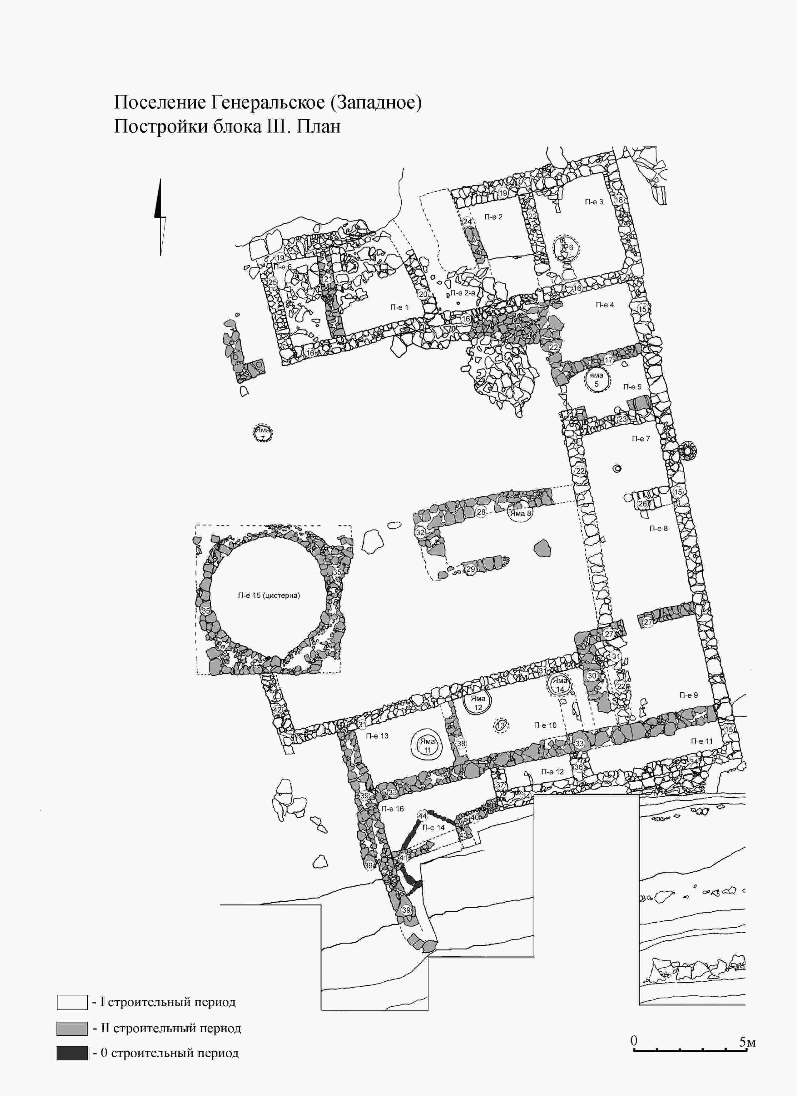
The West Block (Block ΙΙΙ), with an areaof 560 square metres, is situated in the western part of the valley near the rocky descent to the shore. In the south-western part of the Block, a semi-dugout was found which is the earliest built feature within the settlement. It comprised two sections separated by a small wall consisting of a single row of stones. The south section is badly damaged, while the north section consisted of a shallow (20cms) rectangular foundation pit, which had been dug out of the natural clay and had stone-lined walls.
The West Block consisted of three rows of single-storey rooms of one and the same type arranged round the perimeter of a single courtyard (measuring 16 x 16 metres), of which the north-east part had been paved.
During the second construction period, partial alterations were made to the rooms (new walls appeared inside and across the rooms and the outer wall on the south side of the block was two metres further north than before) and the inner courtyard of the block was partly divided in two by the addition of a new room.
During that same period an enormous cistern pit (measuring 5.4 x 5.7 metres and with a depth of 5 metres) was dug out, complete with a ‘canopy’ overhang. The walls of the pit were lined with stones, while the pit itself also served as a temporary grain-store. Not long before the settlement was destroyed, the pit was abandoned and filled with rubbish.
The fortifications of this settlement consisted of a line of ramparts and ditches.

The earliest of the ditches (Ditch II) had been dug 6 metres south of the outer walls of the North Block. It was trapezium-shaped in plan and measured 2 metres deep and 4 metres wide.
The first outer line of the defences consisted of a ditch and rampart protecting all the blocks from falling down the steep slope. They extended over a distance of 140 metres. Ditch II had been dug out of the natural clay and it was wedge-shaped (5-6 metres wide and 2.5 metres deep). In the centre of Ditch I there had been a passage 6.5 metres wide and with almost vertical side walls lined with stones.
The inner line of defence was almost parallel to the outer one and the interval between the two was 10 metres in the East and 30 metres in the West. It began at the north-eastern corner of the West Block and partly covered over the buildings of the East Block. Ditch III had a width of between 3.5 and 5.5 metres (in its central part) and a depth of between 2 and 2.5 metres. The passage serving as an entrance to the settlement was in its central part.
The area empty of buildings between the Blocks had initially extended 35-40 metres from East to West. It would appear initially to have been used for storage purposes and subsequently for an enormous dump of discarded building rubble up to 2.2 metres thick.
Numerous finds have made it possible to date the founding of the settlement to the mid-seventies of the 4th century BC. Around the middle of the second quarter of the 3rd century BC, the settlement was destroyed by a fierce fire and traces of military action are to be found (projectiles for slings, arrows) all over the site. In the immediate surroundings of the settlement, burials of human bodies have been found bearing traces of battle wounds).
Prof. Dr. A. A. Maslennikov